| Language:

List of Protected Areas

Cave Kolokol'naja
Photo: 29Add message: 0

Cave Kolokol'naja

Region, rajon: Chelyabinsk region. g. Katav-Ivanovsk i Katav-Ivanovskij
Category: monument of nature
Profile: geological
The general data: The cave koridorno-grotovogo type also develops in a northwest direction. The input has the form of an arch in height of 3 m, width 4 m, near to the basic input there is one more small input. In total in a cave 4 grottoes: Narrow, Round, Stalactite, Distant. In a distant part of a cave there are formations from calcit, stalactites, stalagmites. ...
Cadastre | On map | Gallery | Slide show | Detailed
Serpievskij karstovyj uchastok
Photo: 6Add message: 0

Serpievskij karstovyj uchastok

Region, rajon: Chelyabinsk region. g. Katav-Ivanovsk i Katav-Ivanovskij
Category: monument of nature
Profile: geological
The general data: The site includes headwaters of the river This with adjoining territory on coast. As of September, 1st, 1994 here cave explorers fix and consider 31 cave with total length of courses 4325 m and the general depth of 295 m. On this site сконцентированы all karstic forms and the phenomena that does the Serpievsky karstic site by the unique sample of ...
Cadastre | On map | Gallery | Slide show | Detailed
Cave Solomennaja
Photo: 8Add message: 0

Cave Solomennaja

Region, rajon: Chelyabinsk region. g. Katav-Ivanovsk i Katav-Ivanovskij
Category: monument of nature
Profile: geological
The general data: The entrance aperture represents an artificial vertical well, its sizes 0,5 on 0,7 m. the Cave abounds with set of various natechno-drop forms: stalactites, stalagmites, натечной a crust on walls. Some stalactites and stalagmites of blood-red colour that is caused by the raised maintenance of iron in calcit. There is an underground lake depth of ...
Cadastre | On map | Gallery | Slide show | Detailed
Cave Jessjumskaja
Photo: 6Add message: 0

Cave Jessjumskaja

Region, rajon: Chelyabinsk region. g. Katav-Ivanovsk i Katav-Ivanovskij
Category: monument of nature
Profile: geological
The general data: The origin this cave is obliged to waters of the river by This. The input in a cave in the form of a small aperture 0,5х0,7 m opens between the basis of a rock and a clumpy blockage. In this place from under the Big Stones the most powerful follows under the expense of waterways. In a cave underground lakes, siphons where it is possible to meet ...
Cadastre | On map | Gallery | Slide show | Detailed
Suhodol reki Sim
Photo: 10Add message: 0

Suhodol reki Sim

Region, rajon: Chelyabinsk region. g. Katav-Ivanovsk i Katav-Ivanovskij
Category: monument of nature
Profile: hydrological
The general data: The river This the most western river of our area. Originates in spurs of Southern Ural Mountains at the city of Amsher. The Particular interest represents an underground watercourse to This. On рассстоянии 850 metres from the Ignatovsky cave upstream the river in a turn place hits in steep rocks and leaves in cracks of rocks and a bottom. Along a ...
Cadastre | On map | Gallery | Slide show | Detailed
Vershina hrebta Bakty
Photo: 29Add message: 0

Vershina hrebta Bakty

Region, rajon: Chelyabinsk region. g. Katav-Ivanovsk i Katav-Ivanovskij
Category: monument of nature
Profile: geological
The general data: The ridge lasts the narrow stony ridge combined by quartzites and quartz-seritsitovymi by slates, continuing a ridge of Nurgush on the southwest from the item of Tjuljuk. Length of the ridge covered прилесьем from a fur-tree, a birch, a bird cherry, about 25 km, height of 1037 metres above sea level. At top, among sites гольцовой zones of mountain ...
Cadastre | On map | Gallery | Slide show | Detailed
Istoki reki Tjul'men'
Photo: 15Add message: 0

Istoki reki Tjul'men'

Region, rajon: Chelyabinsk region. g. Katav-Ivanovsk i Katav-Ivanovskij
Category: monument of nature
Profile: complex (landscape)
The general data: The complex nature sanctuary located in unique territory between mountain ridges Plank beds, Zigalga and Dry mountains. Relicts primary темнохвойной a taiga and широколиственных woods, sites of high-mountainous tundra and subalpine meadows Here have remained. Grow эндемичные plants. Rare vanishing species of animals live. More than 10 small ...
Cadastre | On map | Gallery | Slide show | Detailed
Lukovaja poljana
Photo: 16Add message: 0

Lukovaja poljana

Region, rajon: Chelyabinsk region. g. Karabash
Category: monument of nature
Profile: botanical
The general data: The onions glade is located among the Ufa bogs. The wild onions grow in an abundance. A reference site of mountain riding bogs. Except wild onions grow: борщевик Siberian, a sedge, росянка, купальница marsh, a horsetail.
Cadastre | On map | Gallery | Slide show | Detailed
River Bol'shoj Kialim
Photo: 12Add message: 0

River Bol'shoj Kialim

Region, rajon: Chelyabinsk region. g. Karabash
Category: monument of nature
Profile: hydrological
The general data: The mountain river, originates between mountains Kruglitsa and Itsyl, proceeds on picturesque mountain district. Length of the river - 46 km. Represents a great interest for tourism. At a confluence of the river of Big Kialim of the river Miass the Kialimsky water basin is built.
Cadastre | On map | Gallery | Slide show | Detailed
Lake Ufimskoe
Photo: 12Add message: 0

Lake Ufimskoe

Region, rajon: Chelyabinsk region. g. Karabash
Category: monument of nature
Profile: hydrological
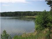
The general data: Small reservoir. The river Ufa follows from lake. The lake hollow is combined гранитоидами. Contains pure, transparent water. Coast are covered by coniferous woods. Is of great importance for the tourism organisation. The lake is in mountains at height 472м. Elks are found In coastal woods, a lynx, there are traces of bears.
Cadastre | On map | Gallery | Slide show | Detailed
Lake Serebry
Photo: 8Add message: 0

Lake Serebry

Region, rajon: Chelyabinsk region. g. Karabash
Category: monument of nature
Profile: hydrological
The general data: Small reservoir. Especially pure water has silvery colour. It is connected with залеганием at the bottom of micaceous slates - as has entitled lake, because of perlamutro-poured colour of mica in lake waters. Has the big scientifically-informative value. Is a source of water supply of Karabash. Depth of lake reaches 4-5 metres.
Cadastre | On map | Gallery | Slide show | Detailed
Kialimskoe vodohranilishhe
Photo: 8Add message: 0

Kialimskoe vodohranilishhe

Region, rajon: Chelyabinsk region. g. Karabash
Category: monument of nature
Profile: hydrological
The general data: Artificial reservoir. Volume of a water basin of 6 million cubic metre. It is formed at a confluence of the river of Big Kialim of the river Miass. A source of drinking water supply of Karabash and Miass. The water basin in 1979 is built located in a beauty spot. From different directions it is surrounded by mountain hills, поросшими coniferous ...
Cadastre | On map | Gallery | Slide show | Detailed
Dzhabyk-Karagajskij bor
Photo: 12Add message: 0

Dzhabyk-Karagajskij bor

Region, rajon: Chelyabinsk region. g. Kartaly i Kartalinskij
Category: monument of nature
Profile: botanical
The general data: Island pine forest. Represents the rests of ancient large forests, there is no time almost entirely covering extensive spaces from east slopes of Southern Ural Mountains to foothills of Altai. In a forest stand the pine ordinary prevails, besides, there is a birch повислая, a birch warty, in lower reaches - an aspen, an alder grey. The pine forest ...
Cadastre | On map | Gallery | Slide show | Detailed
© 2011 Институт минералогии УрО РАН г. Миасс