| Language:

List of Protected Areas

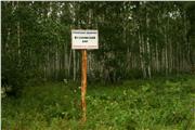
Ujskij bor
Photo: 18Add message: 0

Ujskij bor

Region, rajon: Chelyabinsk region. Ujskij
Category: monument of nature
Profile: botanical
The general data: The island pine forest, is located in a forest-steppe zone (raznotravno-cereal forest-steppe) on granite exits. In a forest stand the pine ordinary with an impurity of an aspen, a birch warty prevails. The specific structure кустарниковой and grassy vegetation is rich. The pine forest has soil-protective, water security, ...
Cadastre | On map | Gallery | Slide show | Detailed
Larinskij bor
Photo: 8Add message: 0

Larinskij bor

Region, rajon: Chelyabinsk region. Ujskij
Category: monument of nature
Profile: botanical
The general data: Island pine forest. Is in a forest-steppe zone on Zauralsky raised plain. In structure the pine ordinary with an impurity of a birch warty, aspens prevails. The underbrush consisting of a mountain ash, a dogrose, кизильника, a hawthorn, a raspberry is rich. From protected grassy plants meet: an adonis spring, a carnation иглолистная, княжик ...
Cadastre | On map | Gallery | Slide show | Detailed
Bulatovskij bor
Photo: 9Add message: 0

Bulatovskij bor

Region, rajon: Chelyabinsk region. Ujskij
Category: monument of nature
Profile: botanical
The general data: An island pine forest. Wood plantings are presented, basically, coniferous - a pine ordinary, also are present - a birch warty, an aspen.
Cadastre | On map | Gallery | Slide show | Detailed
Geologicheskij razrez uglistyh ftanitov s graptolitami (u pos. Bulatovo)
Photo: 12Add message: 0

Geologicheskij razrez uglistyh ftanitov s graptolitami (u pos. Bulatovo)

Region, rajon: Chelyabinsk region. Ujskij
Category: monument of nature
Profile: geological
The general data: Rocky black outs, carbonaceous siliceous rocks, about 30 m tall, stretching along the right bank of the river Uvelki about 400 m. However afiritami basalt, shale bottoms characterize stratigraphic section of the Ural evgeosinklinali. Contain the remains of organic matter (graptolites, radiolarians, acritarchs) of the lower Silurian.
Cadastre | On map | Gallery | Slide show | Detailed
Proval'nyj Kljuch
Photo: 8Add message: 0

Proval'nyj Kljuch

Region, rajon: Chelyabinsk region. g. Ust'-Katav
Category: monument of nature
Profile: hydrological
The general data: Mountain key. Beginning on a wood ridge, soon leaves under the earth. Leaves on a surface only before the confluence of the river of Jurjuzan, on the right, below a crest Quiet. The key also has received the name thanks to that takes place the most part of the way underground. Has scientifically-informative value.
Cadastre | On map | Gallery | Slide show | Detailed
River Jurjuzan' ot Smirnovskogo mosta do ust'ja reki Nasi
Photo: 8Add message: 0

River Jurjuzan' ot Smirnovskogo mosta do ust'ja reki Nasi

Region, rajon: Chelyabinsk region. g. Ust'-Katav
Category: monument of nature
Profile: hydrological
The general data: Begins on mountain Jamantau slopes - the highest mountain of Southern Ural Mountains (1638). Extent of the river within the Chelyabinsk area of 150 km (the general - 404 km). The river Jurjuzan has the biggest difference of heights (850) and a great speed in headwaters. From Ust-Katav and to village Velikie Luki the river has the most picturesque ...
Cadastre | On map | Gallery | Slide show | Detailed
Cave  Bol'shaja Ust'-Katavskaja
Photo: 11Add message: 0

Cave Bol'shaja Ust'-Katavskaja

Region, rajon: Chelyabinsk region. g. Ust'-Katav
Category: monument of nature
Profile: geological
The general data: It is known to local residents as "the Cave of Hapova of a crest". The input is located in crest rocks at height of 17 m from level of the river of Jurjuzan, the width of an input of 10 m, height of 25 m. a cave Cavity consists of three roundish halls with high vaulted ceilings (to 17). The length of courses and grottoes of this cave is equal 42 ...
Cadastre | On map | Gallery | Slide show | Detailed
Skala Mogil'naja
Photo: 4Add message: 0

Skala Mogil'naja

Region, rajon: Chelyabinsk region. g. Ust'-Katav
Category: monument of nature
Profile: geological
The general data: On suburb of the city of Ust-Katava it is located interesting обьект the scientifically-informative value, being a basic cut at geological картировании - a rock Sepulchral. Rocky exits Sepulchral are combined протерозойскими органогенными by limestones.
Cadastre | On map | Gallery | Slide show | Detailed
Salavatskaja peshhera
Photo: 36Add message: 0

Salavatskaja peshhera

Region, rajon: Chelyabinsk region. g. Ust'-Katav
Category: monument of nature
Profile: geological
The general data: Is in 24 km to the north from Ry station Ust-Katav and in 18 km to the north from дер. Мимка. The input is located in a rocky Salavatsky crest, on right to river bank Jurjuzan. The cave begins the big input behind which soon branches on two parts. The cave has historically-memorial value, since in it, on legends, in due time (1774г.) the hero of ...
Cadastre | On map | Gallery | Slide show | Detailed
Cave Stancionnaja
Photo: 12Add message: 0

Cave Stancionnaja

Region, rajon: Chelyabinsk region. g. Ust'-Katav
Category: monument of nature
Profile: geological
The general data: Is on a southern abrupt slope of the right coast of the river of Jurjuzan. An input in a cave in the form of a trapeze in height of 2,5 m and width in the basis of 2 m. the Basic development of courses in a cave - northwest on system of three vertical tectonic cracks. The total length of courses of 280 m, depth of 16 m, the area of a floor of 235 ...
Cadastre | On map | Gallery | Slide show | Detailed
Hvatochnyj Greben'
Photo: 16Add message: 0

Hvatochnyj Greben'

Region, rajon: Chelyabinsk region. g. Ust'-Katav
Category: monument of nature
Profile: geological
The general data: In two km to the south of the former village Kochkari, in right to river bank Jurjuzani, below a river Minki mouth the ridge of the rocky rocks combined by limestones промезойского of age is visible. Limestones of Hvatochnogo of a crest закарстованы. In a crest two caves. In one of them, большей, traces of dwelling of the ancient person are found. ...
Cadastre | On map | Gallery | Slide show | Detailed
Monahov Greben'
Photo: 8Add message: 0

Monahov Greben'

Region, rajon: Chelyabinsk region. g. Ust'-Katav
Category: monument of nature
Profile: geological
The general data: The picturesque kind opens in 24 km to the north from a city where the right river bank Jurjuzan represents the rocky rock reminding the ship, just disengaged. Monks the crest is combined by limy formations and is object sports-tourist and recreational value.
Cadastre | On map | Gallery | Slide show | Detailed
Travnikovskij bor
Photo: 0Add message: 0

Travnikovskij bor

Region, rajon: Chelyabinsk region. g. Chebarkul' i Chebarkul'skij
Category: monument of nature
Profile: botanical
The general data: Extent of a pine forest from the north on the south about 4,5 km, from the West on the east about 5,5 km. The Northeast border of a pine forest passes on the river Koelga. The forest stand consists of following breeds: a pine ordinary, a birch warty, an aspen, a larch Siberian. There are landings of the Siberian cedar. An island pine forest. Has ...
Cadastre | On map | Gallery | Slide show | Detailed
© 2011 Институт минералогии УрО РАН г. Миасс